Diver Navigation & Communication
Diver Navigation/Communication system
The Diver Navigation System by EvoLogics is an innovative solution that enhances underwater missions by providing precise map-based navigation, real-time positioning - with the locations of all team members available to every diver and the surface crew - and text-based communication for professional diver teams.
The system enables seamless interaction between divers and the surface team, as well as among divers themselves - significantly improving situation awareness, operational efficiency, and diver safety.
With its unique combination of map-based mission planning and live diver tracking, two-way text messaging and real-time sharing of geo-referenced points of interest, the Diver Navigation System empowers teams to manage complex underwater tasks with clarity and control. Whether you are conducting sensitive search and rescue operations or detailed salvage and environmental surveys, the system increases mission success and optimizes team coordination below the surface.
The system consists of acoustic diver trackers interfaced with diver displays and an acoustic surface gateway, all managed through the intuitive and user-friendly SiNAPS software platform. This setup ensures accurate positioning and stable communication links - even in noisy or low-visibility environments - making it an essential tool for a wide range of diver operations.
Main Features - Diver Navigation System
The Diver Navigation System combines innovative features that enhance operational flexibility, mission success, and diver safety in challenging underwater environments.

Intuitive user interface
The system features a user-friendly, intuitive interface with individual configuration options and quick access to multiple software settings, enhancing operational efficiency and situational awareness so divers and surface teams can focus on mission priorities.
Components - Diver Navigation System
With its modular setup, user-friendly interface, and acoustic compatibility across EvoLogics’ product range, the Diver Navigation System adapts to the specific requirements of each mission and to meet the needs of the professional community.
-
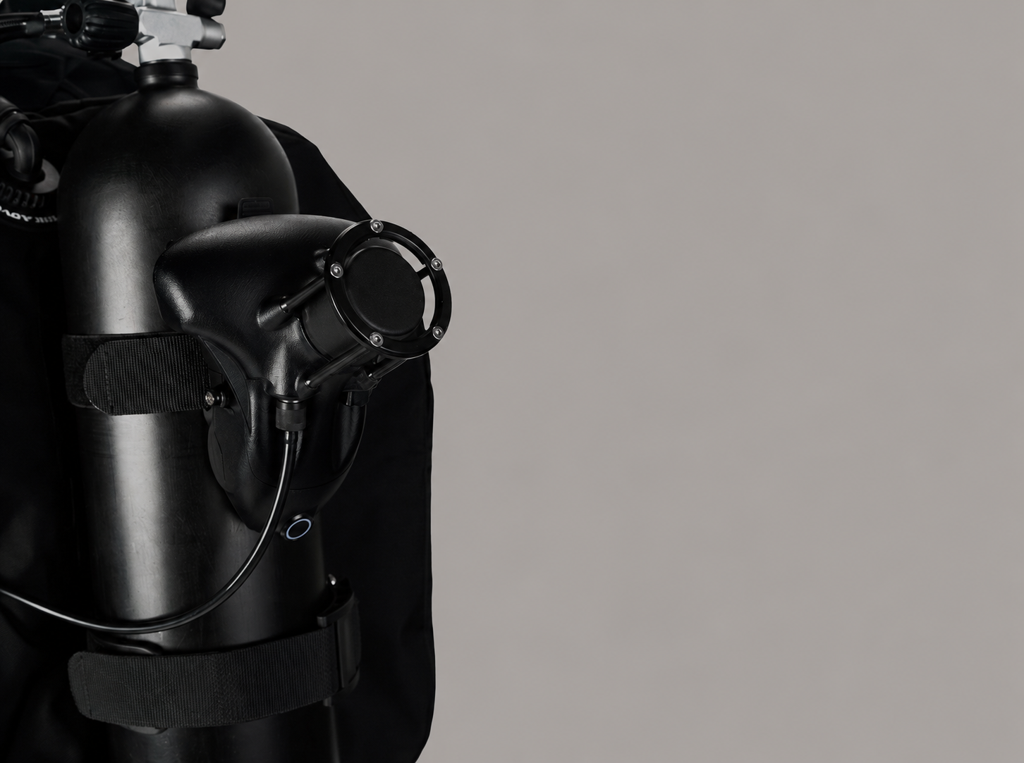
![Diver tracker - Diver Navigation]()
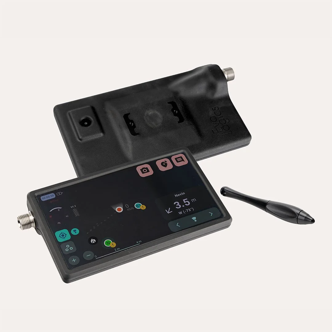
Diver tracker
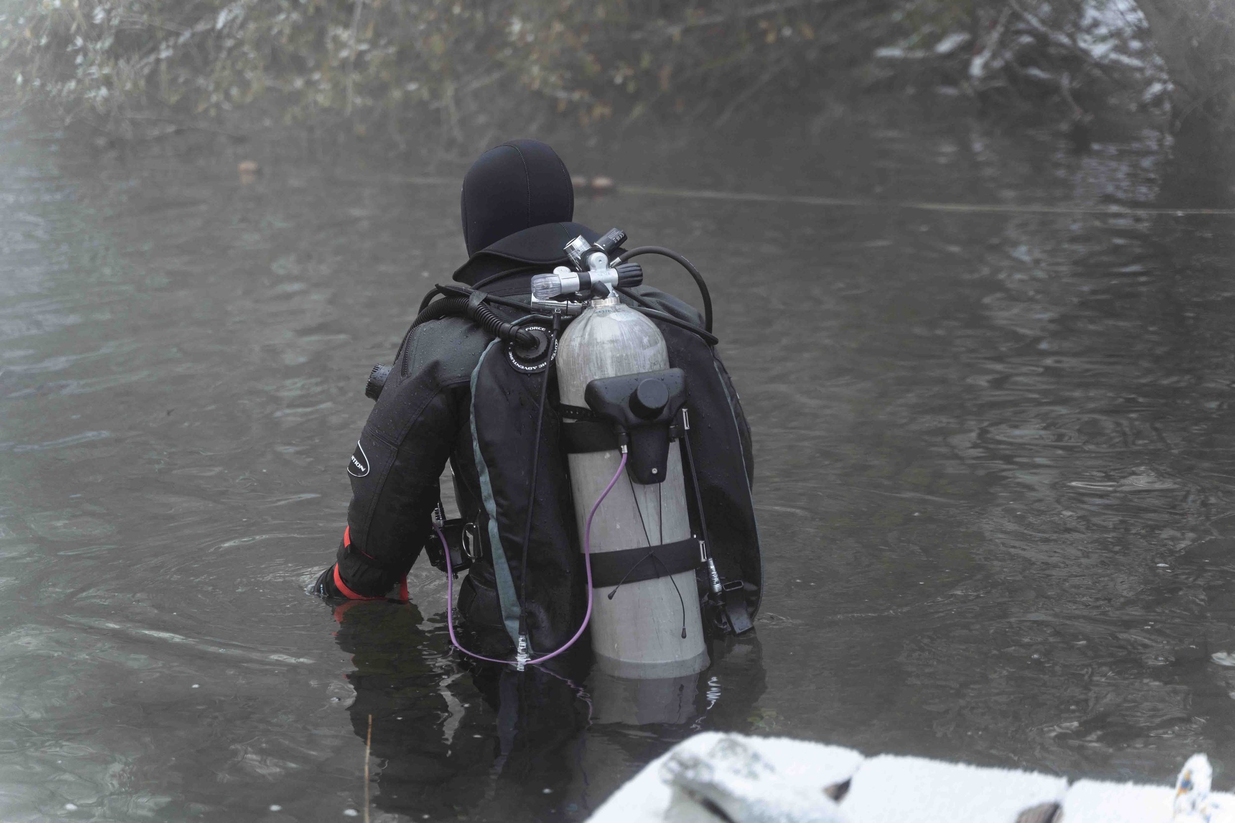
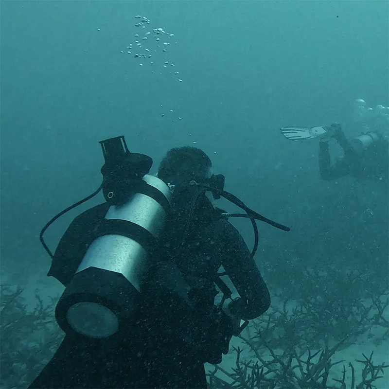
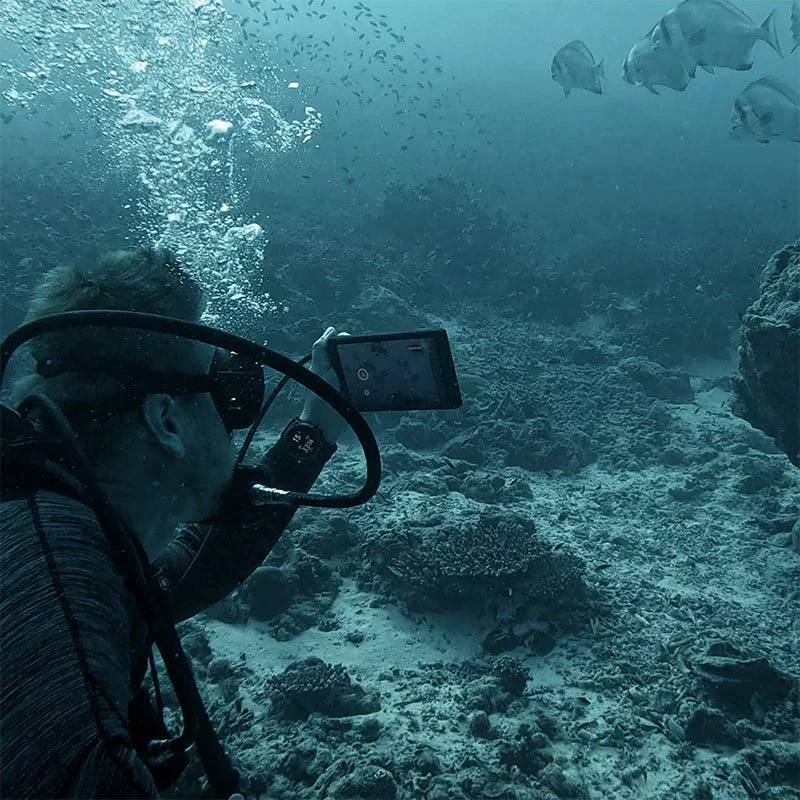
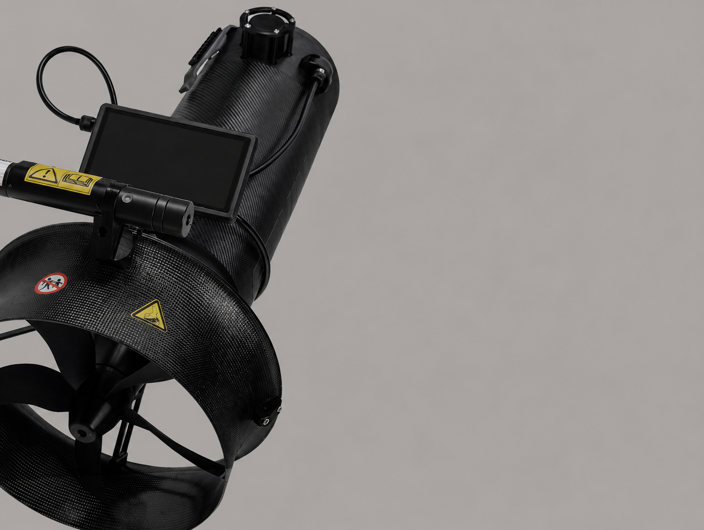
The compact, battery-powered unit is based on EvoLogics 18/34 modems. It is mounted directly on the diver’s gear or integrated into the GAVIN scooter for unobstructed acoustic transmission. It continuously tracks the diver’s position and transmits data to the surface buoy in real time. Rugged, lightweight and diver-friendly, it delivers precise positioning and reliable acoustic communication even under challenging conditions.
-
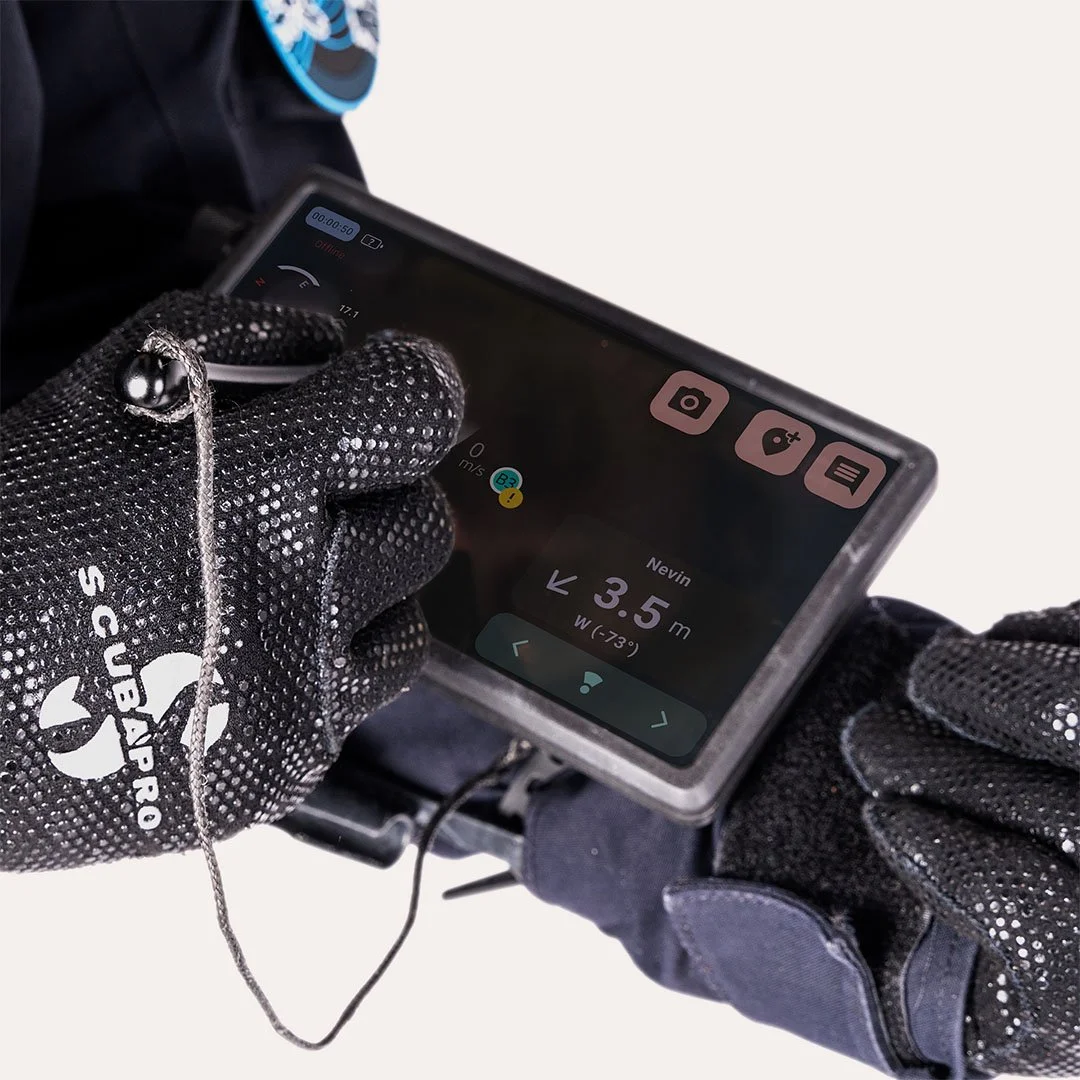
![Diver display and stylus - Diver Navigation]()
Diver display and stylus
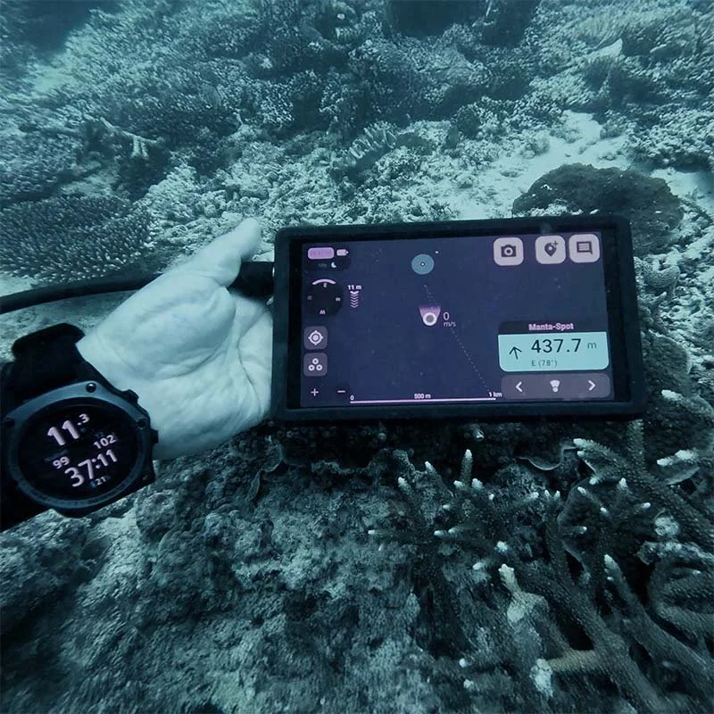
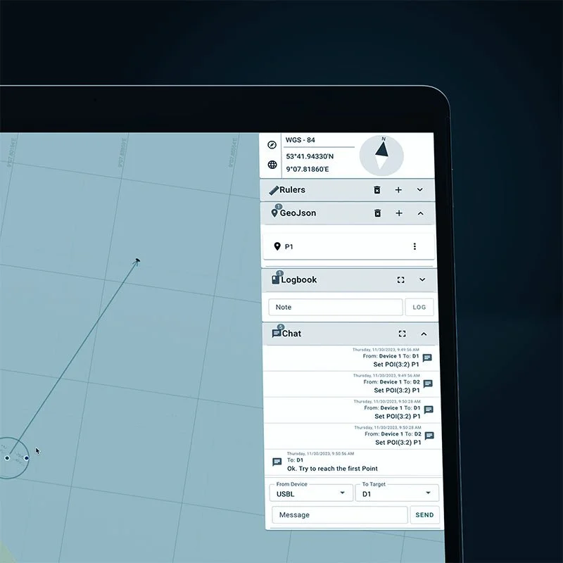
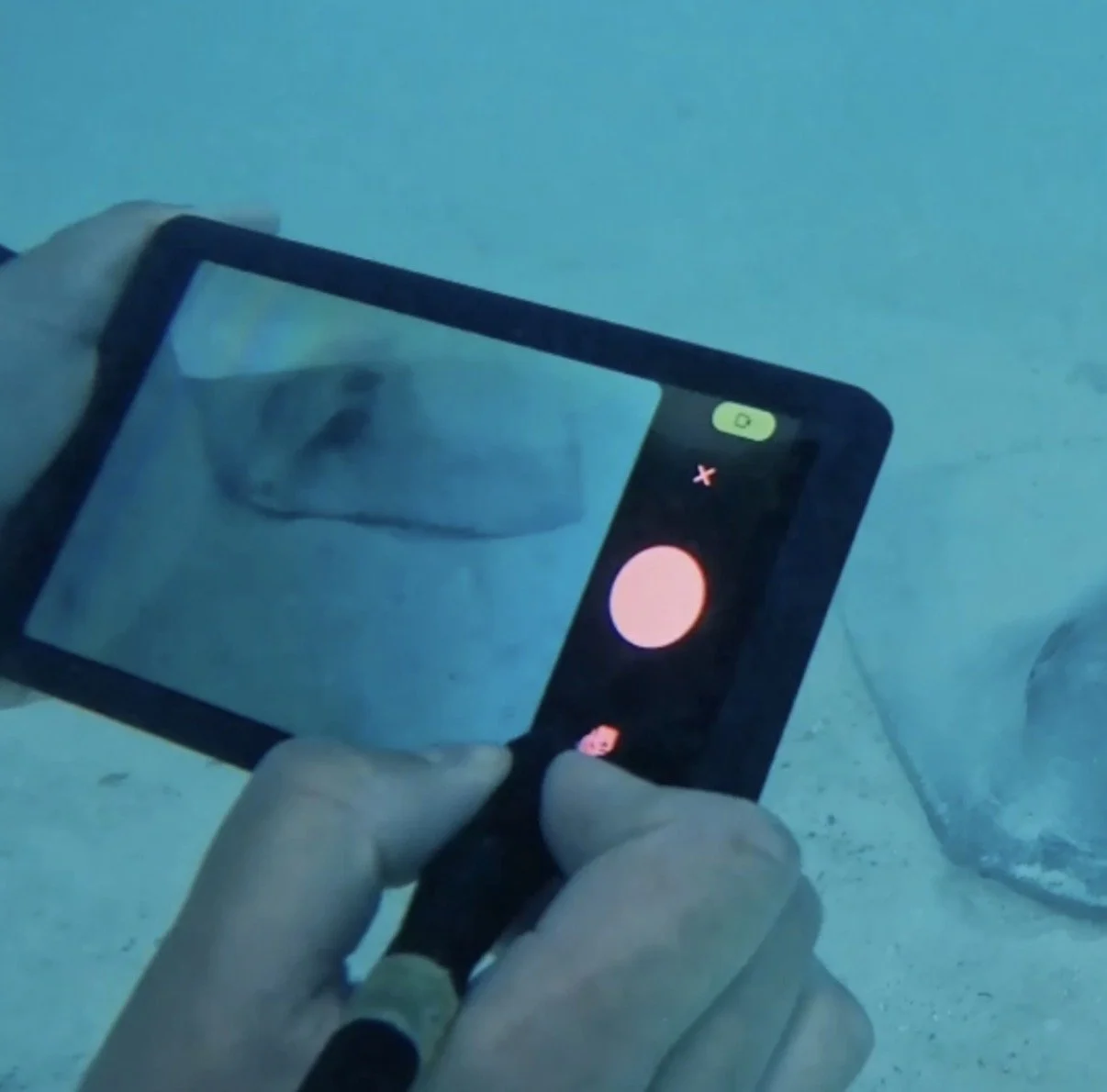
The diver display connects to the diver tracker with a cable. It is a wrist-mounted, quick-release tablet running the intuitive SiNAPS Dive interface. Fully functional down to 150 m deep, it shows the mission map, positions of other divers and vessels, points of interest and chat messages, while also enabling divers to capture and share photos during the mission. Operated with a stylus designed specifically for underwater use, the display allows precise interaction with the interface, making it easy to select elements and respond promptly to incoming messages or task updates.
-
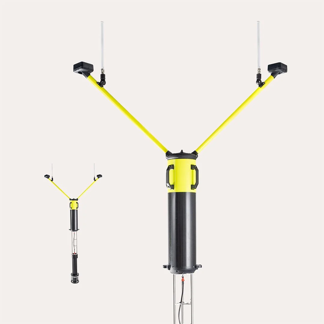
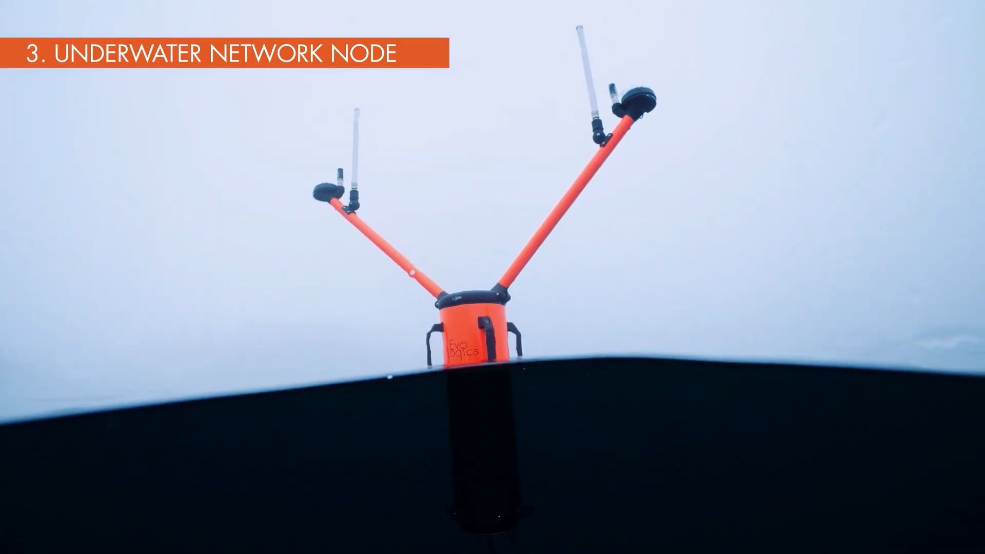
![Surface node - the USBL Buoy - Diver Navigation]()
Surface node - the USBL Buoy
The floating USBL Buoy is the central surface node for acoustic positioning and mission management. A compact, all-in-one battery-powered unit with a USBL antenna, GNSS and SiNAPS software running on its onboard PC, it keeps the underwater team connected and tracked in real time. Ready for immediate deployment from vessels or fixed stations, it provides reliable mission data and ensures smooth coordination between divers and surface teams.
-
![Mobile Surface node - Sonobot 5 USV with USBL]()
Mobile Surface node - Sonobot 5 USV with USBL
The Sonobot 5 unmanned surface vehicle equipped with a USBL arm is a mobile alternative to the stationary buoy. Operating as a surface node, it can actively follow diver teams, keeping them within optimal range for positioning and communication. Like the buoy, it integrates a USBL antenna, GNSS and onboard PC running EvoLogics’ SiNAPS software, providing real-time tracking, mission control and data exchange. By combining these functions with the mobility of an autonomous surface drone, the Sonobot ensures continuous coverage and extends operational flexibility for diver missions.
-
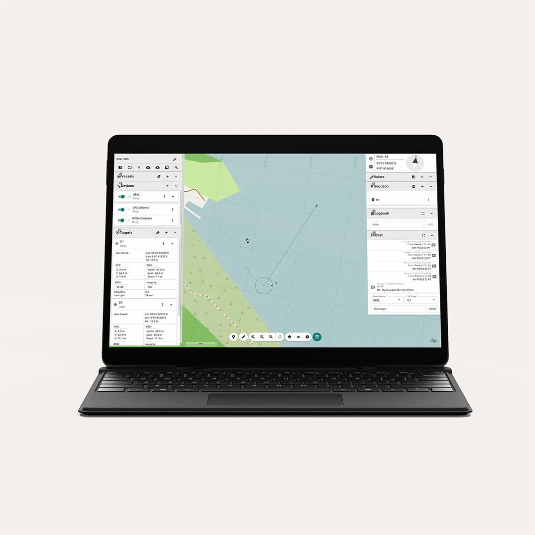
![SiNAPS positioning software - Diver Navigation]()
SiNAPS positioning software
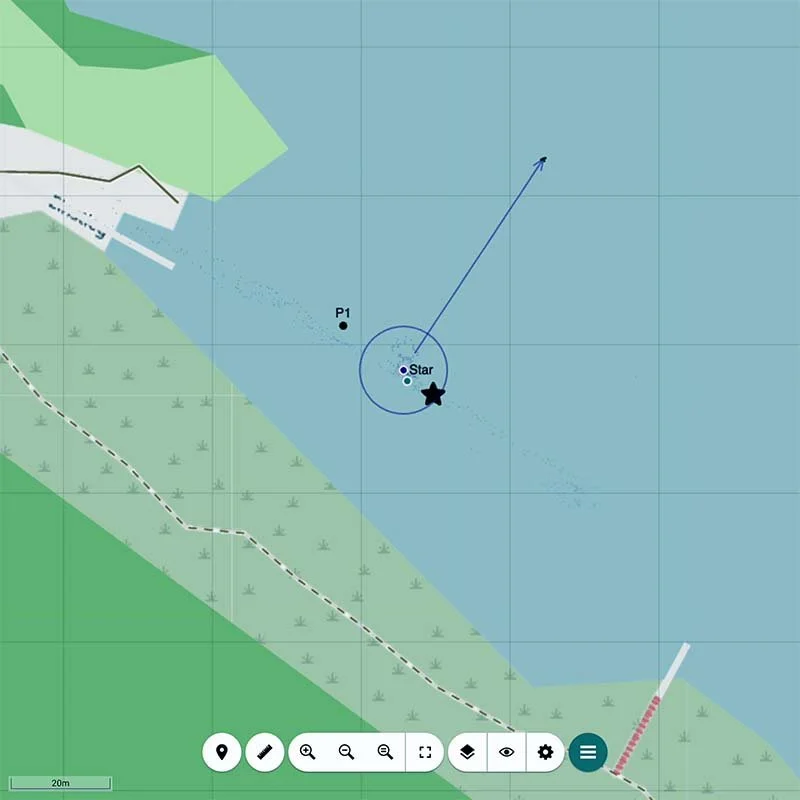
The SiNAPS positioning software serves as the mission control platform for surface teams, displaying live diver positions, managing points of interest, and enabling two-way messaging. Supporting real-time data exchange between multiple divers and surface crew, it creates a shared situational awareness environment for all participants. By providing the surface team with a clear, real-time view of the mission area, SiNAPS helps to coordinate tasks, respond instantly to changing conditions, and maintain full operational control. SiNAPS can be opened in any modern web browser on devices within the local network of the USBL Buoy and used on multiple screens at once for shared mission oversight.
-
![SiNAPS Dive software - Diver Navigation]()
SiNAPS Dive software
The SiNAPS Dive software is optimized specifically for diver displays. Its clean, intuitive and user-friendly interface clearly highlights essential mission data, enabling divers to interact quickly and efficiently by using a stylus. The software ensures that all divers share and see the same live data as the surface team, enabling perfectly synchronized actions underwater. Designed to enhance navigation and communication during underwater missions, SiNAPS Dive provides real-time tracking of diver positions, mission details, and points of interest. Divers use the display to manage mission settings, monitor tracking data, capture photos, and communicate seamlessly with team members.

Configuration Options
The Diver Navigation System is available in two setup configurations, tailored to different mission profiles: standard dives or operations with dive propulsion vehicles.
-
![Tank Mount Configuration - Diver Navigation]()
Tank Mount Configuration
In this setup, the acoustic modem unit is attached to the diver’s scuba tank, while the display is worn on the diver’s wrist. This arrangement offers excellent flexibility and mobility during missions, making it ideal for standard diving operations where ease of movement and quick interaction with the diver display are crucial. Divers can effortlessly monitor mission data and communicate while maintaining full control over their equipment
-
![Scooter Configuration - Diver Navigation]()
Scooter Configuration
The Diver Navigation System is available fully integrated with the GAVIN NT Scooter (40V) for missions that require extended range and high maneuverability offered by dive propulsion vehicles. The acoustic modem tracker is built into the scooter directly, and the display is securely mounted on the vehicle, keeping all components firmly in place. The integrated modem does not affect the scooter’s performance, making this configuration ideal for extended-range operations, rapid transit to remote sites, and conserving diver energy during long or physically demanding missions.
Technical Specifications
Encrypted acoustic communication
Range up to 1.5 km
Acoustic frequency
18-34 kHz
Positioning
Positioning in absolute geo-coordinates
Slant range accuracy
+/- 10 cm
Battery duration
Up to 8 hours
Map waypoints can be added before or even during the mission to coordinate operations, and mark discovered objects or infrastructure for further investigation
Diver Navigation/Communication system
Much like texting on a smartphone, the system allows a team of divers to exchange short messages with each other and the surface, while also providing real-time tracking of each other’s positions.
System components
The battery-powered diver tracker unit is compatible with all EvoLogics 18/34 modems and systems. It comes with mounts to attach it either on the diver’s scuba tank or to most of the common underwater scooters. The molded unibody design of the tracker ensures broad compatibility with various diving equipment and facilitates straightforward installation.
Surface team can track divers, monitor their positions, send messages, and define/change waypoints
Divers can see their own positions and the position of the team members on a visual map
Divers can set and receive waypoints and points of interest and share with all team members.
Locations can be marked in absolute geo-coordinates for later use and/or vehicle deployment
Divers can communicate with each other and with the surface team
The diver console is a compact wrist tablet that connects to the tracker modem by cable. It provides the diver access to the SiNAPS user interface - EvoLogics positioning software visualizing the map of the current operations area, the positions of all divers and the support vessel, and running the text chat tool.
At the surface, the USBL buoy acts as the acoustic node for operations. This device, a mono-unit with a USBL antenna, an integrated PC running SiNAPS positioning software, a dual-antenna GNSS receiver, and a WiFi access point, is designed for mobile scenarios. The Buoy ensures rapid setup and fully supports bidirectional diver tracking and message exchange.
The USBL buoy calculates diver positions using acoustic signals and displays them in the SiNAPS interface for the support team. This capability allows the surface team to monitor diver positions, communicate messages, and adjust mission waypoints as needed. Bidirectional acoustic links ensure that all mission divers have access to tracker positions.

Diver Navigation · Diver Tracking · Communication · Coordinate operations · Search and Rescue · Salvage operations · Recovery efforts · Cleanup operations ·
Diver Navigation · Diver Tracking · Communication · Coordinate operations · Search and Rescue · Salvage operations · Recovery efforts · Cleanup operations ·
Specification Diver Navigation/Communication
Encrypted acoustic communication, range up to 1.5 km, acoustic frequency18-34 kHz
Positioning in absolute geocoordinates, slant range accuracy +/- 10 cm
Battery duration up to 8 hours
Max. depth rating 50 m
Simultaneous tracking of up to 5 divers
Messaging to/from up to 100 divers