
Geoinformation: A Critical Tool for Modern Decision-Making
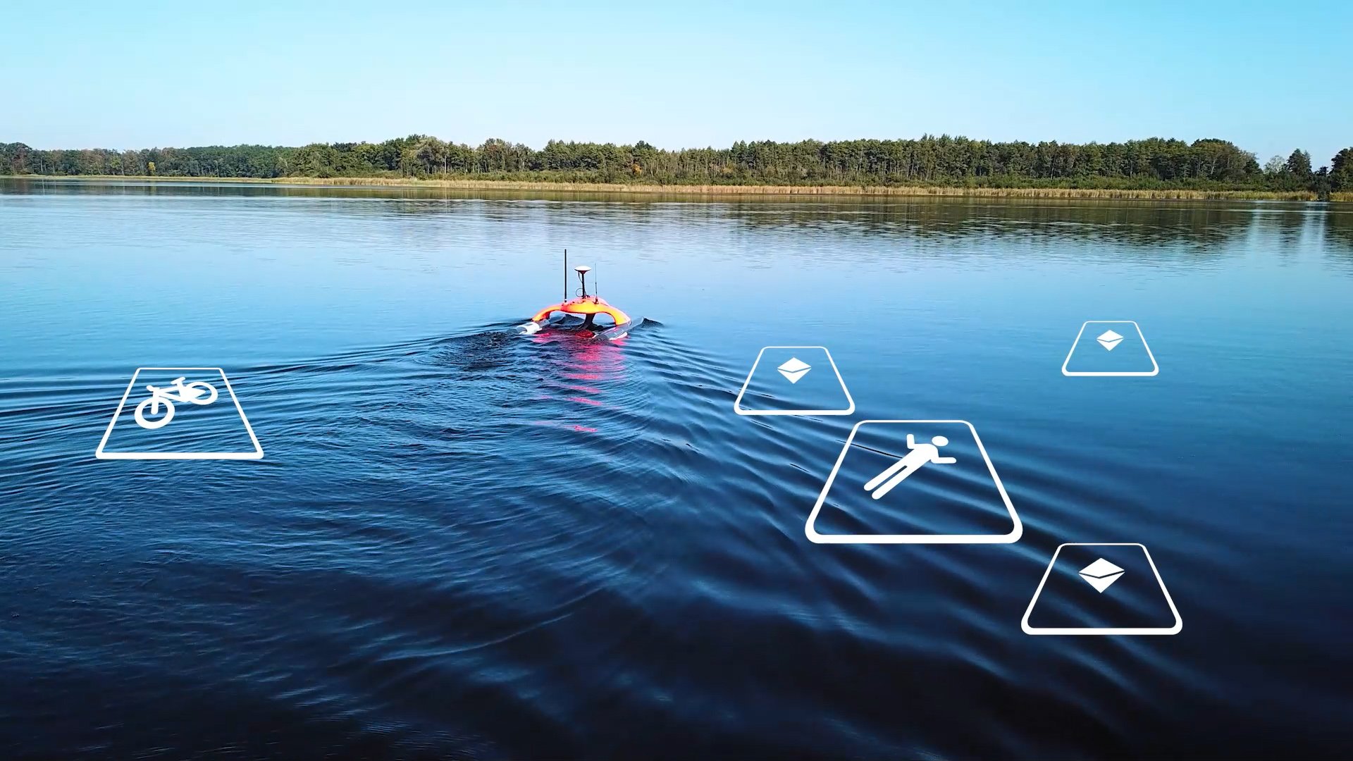
Geoinformation underpins decision-making in urban planning, transport and energy infrastructure, defense, military missions, disaster prevention, response and environmental protection.
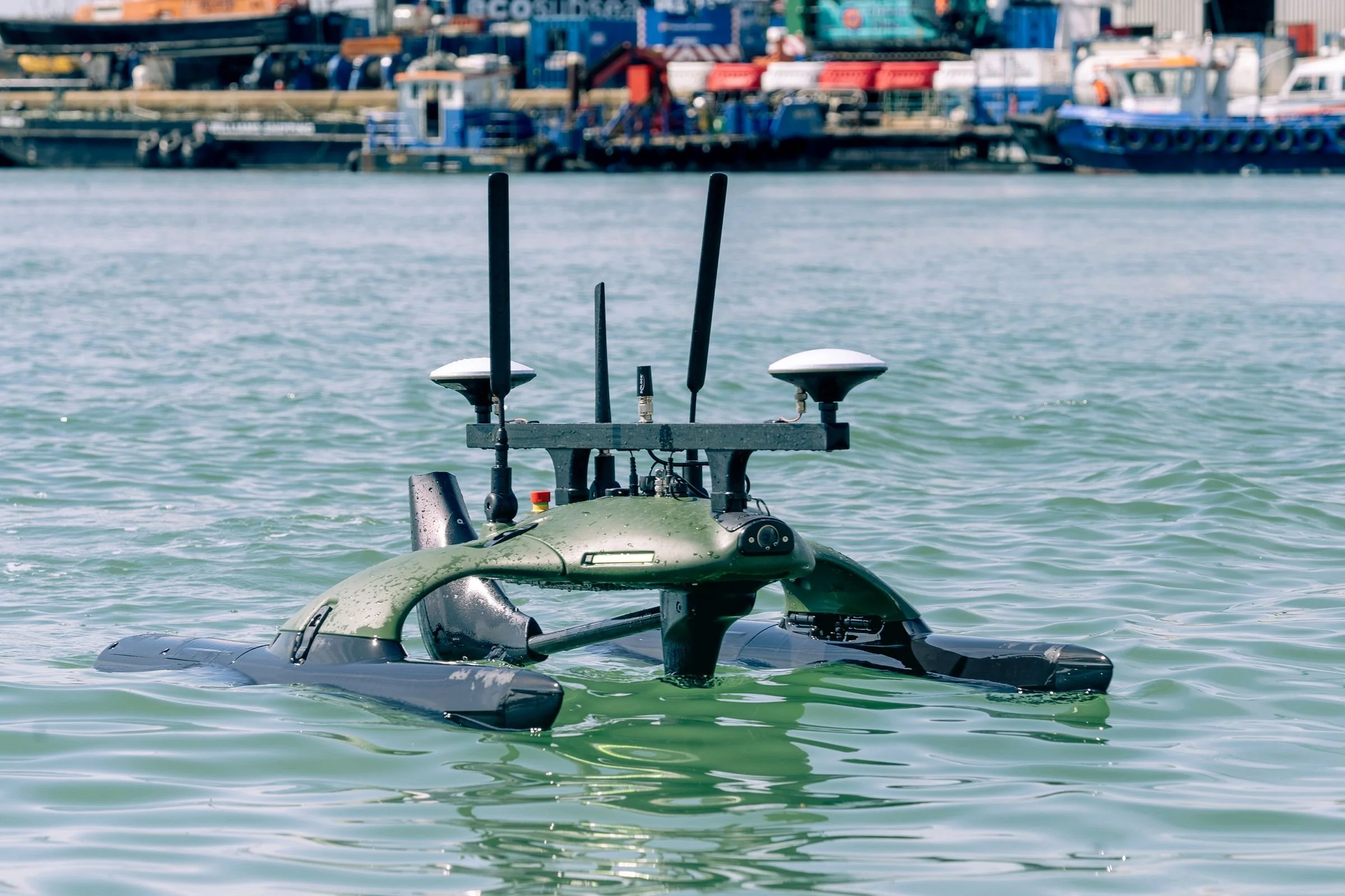
Sonobot 5 with USBL (left), Sonobot 5 with single-beam echosounder, side-scan sonar and long-range radio (right).
The underwater domain brings an important dimension to geoinformation. This is where EvoLogics brings 25 years of innovation in underwater communication, positioning and robotics. With the compact unmanned surface vehicle (USV) Sonobot 5 – a versatile platform that extends geodata collection to rivers, lakes, ports and coastal environments, combining autonomy and advanced sensing with a streamlined, user-friendly design.
This flexibility opens up new possibilities for underwater missions, making Sonobot 5 a powerful asset for both civilian and defense applications.
Sonobot 5 – Autonomous Survey Catamaran - More than vust a Survey Tool
Sonobot 5 USV equipped with USBL
Smart, Portable, Ready to Deploy The Sonobot 5 is a foldable, twin-hull USV designed for fast, accurate hydrographic surveys in inland and coastal waters. Built for single-operator use, it combines autonomy, precision, and flexibility.
Sonobot 5 isn’t limited to hydrographic surveys—it’s part of EvoLogics’ advanced underwater technology ecosystem, making it a versatile tool for smart subsea operations.
Equipped with a USBL system, it can also function as a floating communication hub for autonomous underwater vehicles (AUVs) like the Quadroin, relaying data between submerged equipment and shore-based control—no need for fixed buoys.
Quadroin AUV
Sonobot can also act as a mobile surface node for EvoLogics’ Diver Navigation System, following divers to keep them connected and within range.
AI-tracking Diver navigation and communication system
Object recognintion
A particularly valuable upgrade for the Sonobot is the AI-powered object recognition module, which analyzes raw sidescan sonar data directly onboard. Identified objects are instantly highlighted within the control software. The system supports cloud connectivity, receives regular updates with new object categories, and can be trained using user-provided datasets to detect custom targets.
Key Applications
Versatile Across Industries
Bathymetric mapping
Structure inspection
Environmental monitoring
Search and recovery operations
Defense and security missions
Tailored to Your Mission
GNSS: DGPS, RTK, or laser tracking
Sonar: single-beam, multibeam, sidescan,
forward-looking
Cameras: overwater, underwater, stereo, thermal
AI-based object recognition (optional)
Technical Highlights
Compact Yet Powerful
Foldable carbon-fiber catamaran
Tool-free assembly and launch
Up to 9 hours runtime
Swappable battery pack
Survey speeds: 0.5–1.5 m/s
Top speed: 5 m/s
Operates in clean or contaminated waters
Smarter Sonar Analysis
Real-time detection from sidescan sonar
Highlights targets in control software
Cloud-ready and customizable with user datasets
Regular updates with new object classes
Why Sonobot 5 USV?
The Advantage
Rapid deployment
Modular and scalable
Professional-grade sensors
Designed for real-world conditions
Supported by BUVI Scandinavia’s expertise

Francisco Bustamante Evologics and Fredrik Fleetwood BUVI Scandinavia
Let’s Talk Interested in a demo or quote?
Europe:
Phone: +46 70 697 77 75
E-mail: buvi@buviscandinavia.com
USA:
Phone: +1-484-356-3889
Email: shawn@buviscandinavia.com